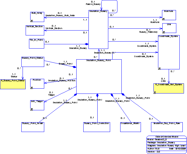

From the diagram above in the SDS database the concept of a deviation survey is represented by 3 major classes (Deviation_Survey, Deviation_Survey_Point and Tie_In_Point).
To create a deviation survey in the SDS database you should create a record in the Deviation_Survey table for the survey information such as the type of survey, the mode of the survey and the survey date. The data that defines the tie-in point of the Survey is stored in the class called Tie_In_Point. A deviation survey should be described in association with a coordinate reference system and by convention this should be the same coordinate system that is defined as being the working coordinate system for the borehole. By doing this surveys can more easily be compared to each other.
A deviation survey is composed on a number of points along a borehole where the inclination (deviation from the vertical), azimuth (deviation from North) and Measured Depth (measured from the vertical reference of the coordinate system). In addition to this when a survey is processed then the calculated data such as true vertical depth (TVD) and East and North offset can be calculated and entered into the survey point entries.