Example Stratigraphic Data
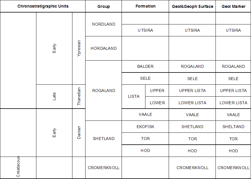
The Norwegian North Sea Stratigraphic Chart (figure 1 below) provides an example of formal stratigraphic data available for tagging geologic and geophysical interpretations. In this example, there are four levels of geologic feature names provided. The four sets of names shown here are; Geochronology � presenting time intervals for layer deposition, Lithostratigraphic including Group and Formation names, Geologic or Geophysical surface names, and Marker names for intersections of the geologic surface with a borehole. The first three, Geochronology, Lithostratigraphic and informal naming are addressed in this section. Appling names to markers and zones are covered in the following section.
Figure 1 Example of stratigraphy data from the North Sea of Norway
It is common practice to establish some combination of these various methods for defining geologic features. It is possible to create earth models with various combinations of stratigraphic definitions for surfaces, layers, and markers. They may follow either formal or informal naming conventions. Industry practice ranges across the spectrum and may differ based on the purpose of the study and the maturity of the geologic literature in the area. Here we will describe from surfaces and then layers. These will be shown in both in reference scope and then into the project area where more information can be added. Sometimes regional names are given formal names and local names are given informal ones. Another area of concern includes the use of the same name for different objects. This can often lead to confusion when a layer and a surface have the same name. While best practices suggest that different types of features should maintain separated naming conventions, people often mix layer and surface names. Remember, even if the names are the same the underlying objects are different things.
Figure 2 Cross section with formal stratigraphic nomenclature values for the �Ekofisk Formation�, shown in the Norwegian North Sea stratigraphic chart (Figure 1).
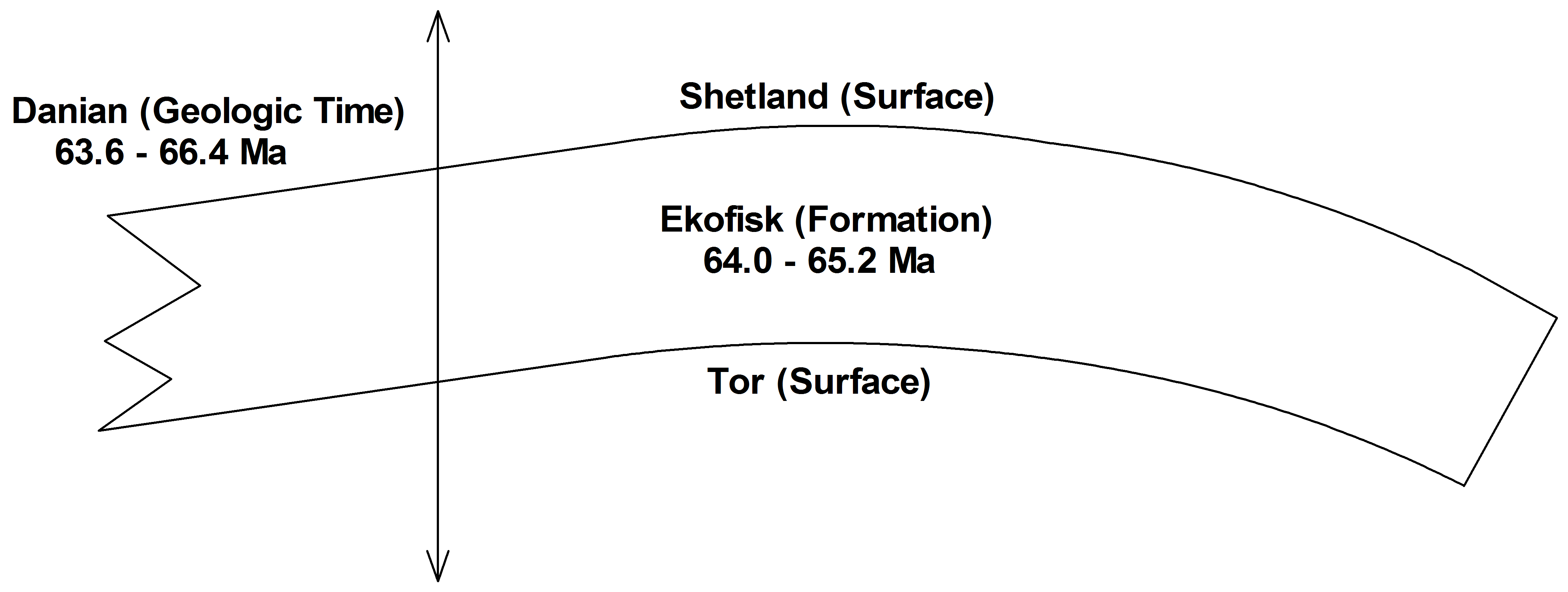
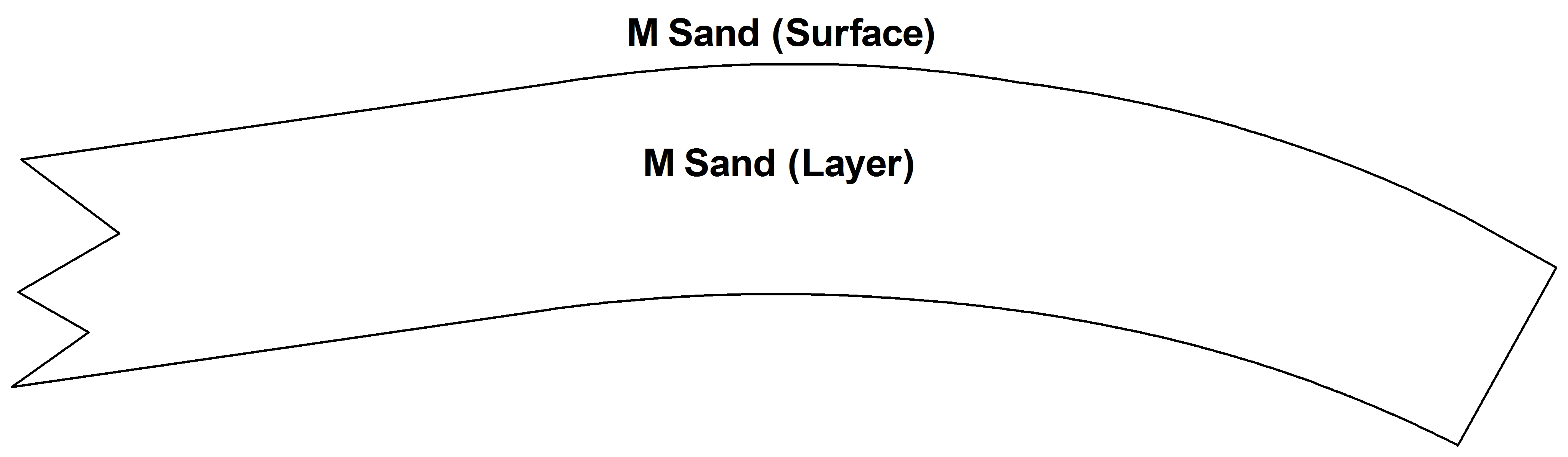
Figure 3 Cross section with informal stratigraphic nomenclature values for the �M Sand�.
Geologic Markers will not be discussed in this example but surfaces and layer information is the basis for the discussion of markers in the following section.