Oil and gas are generally produced from reservoirs under the earth. These reservoirs must have porosity, that is, space within the rock to hold the fluid, permeability, or connection between the spaces so the fluid can flow, and closure, a sealing mechanism around the reservoir so that the hydrocarbons do not flow off. Wells are drilled into the reservoirs to bring the hydrocarbons to the surface if there are any present in the reservoir. Examples of some types of geologic structures that form traps are shown below.
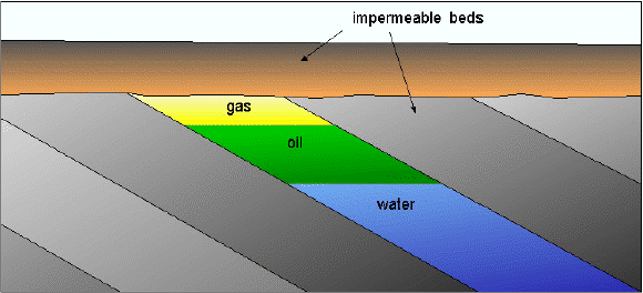
Figure 1 � Gas and oil trapped in an unconformity
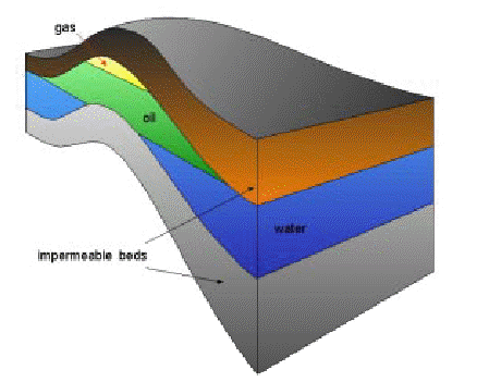
Figure 2 - An anticline trapping hydrocarbons.
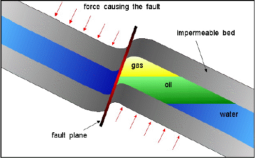
Figure 3 - A fault trap.
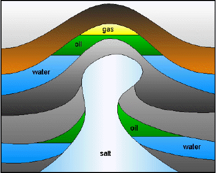
Figure 4- Hydrocarbons trapped around salt dome.
A potential well site can be identified if one of these structures can be located from the surface and if it can be determined that there is likelihood that hydrocarbons are trapped by the structure.
The seismic method is one of the most commonly used techniques to find hydrocarbons buried beneath the earth surface. Most seismic surveys utilize the seismic reflection method which gives an accurate representation of the subsurface structure by measuring the time it takes for a seismic wave generated at or near the surface to reflect from rock interfaces and return to the surface. Instruments that detect either ground movement or changes in water pressure, depending on whether the survey is on land or water, convert the reflected waves to electrical signals that are digitized and recorded on tape. The seismic survey is subsequently processed and the results of the processing are interpreted to provide a picture of the subsurface and properties of the materials in the subsurface.