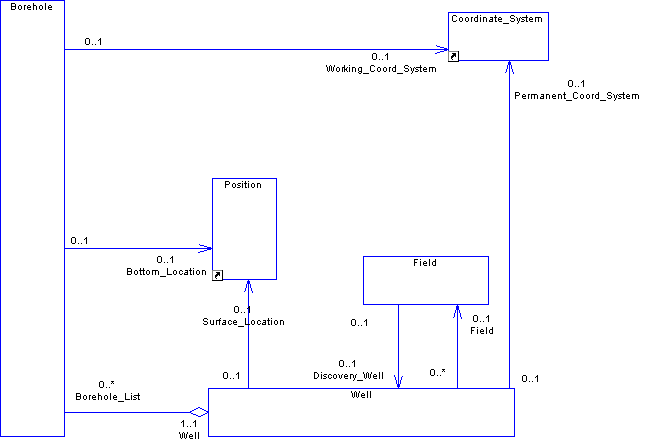
From the diagram above, in the Seabed database the concept of a well is represented by 2 related data objects called Well and Borehole. A well is defined as being "A collection of (zero or more) boreholes drilled into the earth for the purpose of either (1) finding or producing underground resources, or (2) providing services related to the production of underground resources." A Borehole is defined as being "A unique, oriented hole from the intended bottom of a drilled interval to the surface of the earth. If more than one path exists from a borehole bottom point to a surface point, more than one borehole exists. The borehole provides a conduit for operations within a well."
To create a well in the Seabed database you should create a borehole in addition to a well. A well has a permanent coordinate system associated with it to show the permanent datum and permanent datum elevation (these are stored as the vertical reference and Z offset of the coordinate system). A borehole has associated with is a "Working" coordinate system. This coordinate system defines the reference datum to which all data that is loaded regarding a borehole should be normalized. For example, all measured depths are expressed with respect to the vertical reference and Z offset of the working coordinate system for a borehole.
By convention, the surface location of a well should be expressed in terms of the coordinate system for the project. Therefore, if someone loading data to a Seabed database does not know the coordinate system in which the surface location of the well is expressed, then it should be assumed that it is in terms of the project coordinate system. Also some customers will give data in both a geodetic and projected coordinate system. If this is the case then only one should be stored. The preferred choice is geodetic.